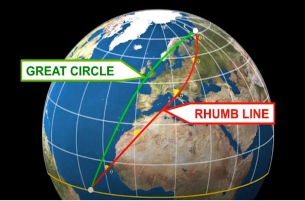
In the realm of cartography and navigation, the advent of Mercator projections by Gerardus Mercator in the 16th century revolutionized how we perceive geographic data. Mercator’s innovation, known for maintaining consistent scale changes across both north-south and east-west directions, paved the way for efficient navigation techniques, particularly through the establishment of Rhumb lines. These lines, cutting meridians at consistent angles, simplified early navigators’ journeys by offering a single track angle to follow throughout their voyages.
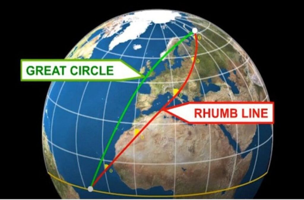
Despite their convenience, Rhumb lines possess a critical drawback: they do not always represent the shortest distance between two points on the Earth’s curved surface. The concept of Great circle routes, akin to pulling a string taut over a globe, illustrates the shortest path between two locations. Unlike Rhumb lines, Great circle routes vary their track angles at each meridian, ensuring optimal efficiency in travel, particularly for modern airplanes.
Modern aviation predominantly employs Great circle routes due to their efficiency in minimizing travel time. However, the depiction of these routes on Mercator charts, commonly seen in airline route maps, showcases curved lines to accurately represent the Great circle’s trajectory. Conversely, Rhumb lines appear as straight paths on such charts.
Despite the ideal representation of Great circle routes, practical constraints such as airspace closures or weather conditions may necessitate deviations from the optimal path, leading to longer routes that do not align with the shortest Great circle route between two points. Nonetheless, advancements in navigation technology, including onboard computers, have significantly mitigated the challenges faced by early navigators, ensuring precise calculations and route planning for modern aviation.
Author – Nischal Paudel


